Assessing Coastal Flood Risk with Maine Communities
Expanding Maine’s network of tide gauges and working closely with communities to identify flood thresholds.
The Gulf of Maine Research Institute is partnering with the coastal Maine communities of Machias, Saint George, Boothbay Harbor, and Portland to collect local water level and flood impact data. We are piloting processes that support translation of data for local decision-making and intergenerational community engagement.
Project Goals:
- Install Hohonu tide gauges in four coastal Maine communities (Machias, Saint George, Boothbay Harbor, and Portland), and collect local flood impact observations through community science programs led by local community organizations and educators.
- Develop a framework for municipal-scale siting of gauges for high water monitoring applications.
- Support local-to-regional decision-making and emergency management by integrating data into National Weather Service forecasting.
- Develop data products in support of ongoing coastal resilience projects.
- Pilot a sea level rise and coastal flooding curriculum that engages youth in local data collection and conversations with decision-makers in their communities.
- Develop interactive platforms for robust and sustainable access to water level and community science data.
Project Materials
Communities can use tide gauge measurements and local observations of coastal flooding to support better coastal planning for a more resilient future. Click the links below to view real-time water level data, explore community-collected coastal flooding information, and document your own observations.
Access real-time tide gauge data for:
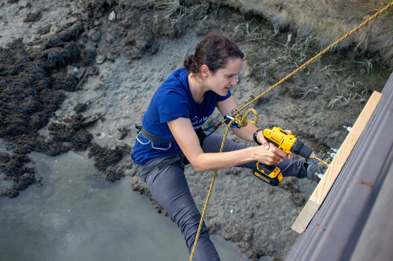
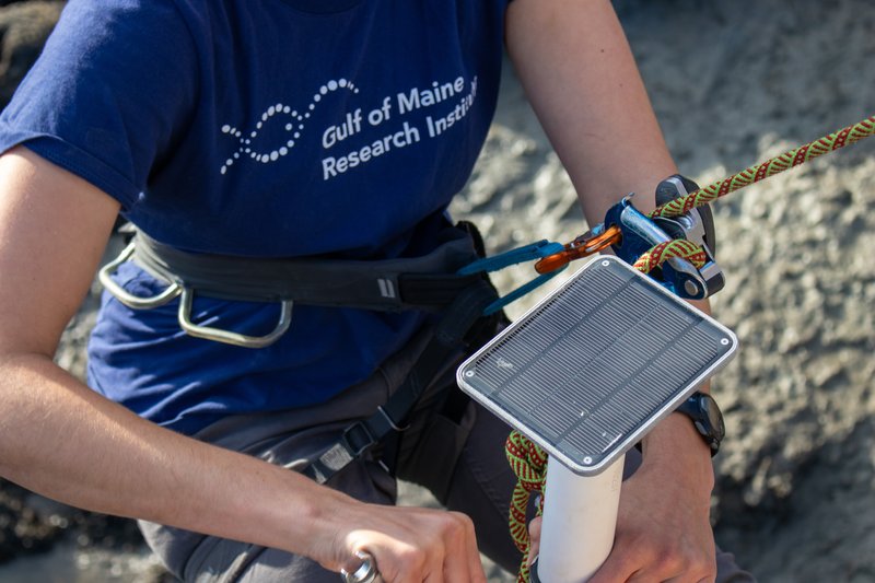
Machias: We installed two Hohonu tide gauges on a piling at the boat ramp next to Helen's, with the help of James Jutras of Sunrise County Economic Council. We are testing two technologies — one that measures water level with radar, and one that measures with ultrasound.
Saint George: We installed this gauge at the Port Clyde Fishermans Co-op on 11/8/2023. Thanks to Gerry Cushman for the support. Note that there is another gauge installed at Southern Island, and it will go offline in March 2024.
Boothbay Harbor: We installed this gauge on the Department of Marine Resources Pier on 6/2/2023.
Portland: We installed this gauge in the Fore River Sanctuary on 10/13/2023, with the help of Kevin Deneault, City of Portland GIS Mapping Specialist.
Coastal Flooding and Sea Level Rise Curriculum for Teachers:
- View and download the 5 – 8 grade curriculum being piloted in partnership with teachers in Machias, Boothbay Harbor, St. George, and Portland this school year: "Coastal Flooding and Sea Level Rise: Understanding, Monitoring, and Action."
About the Project
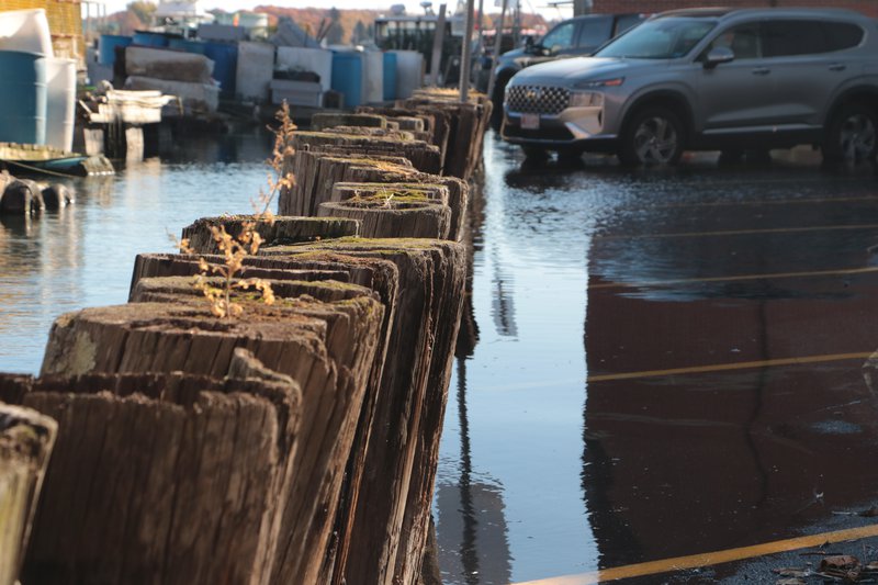
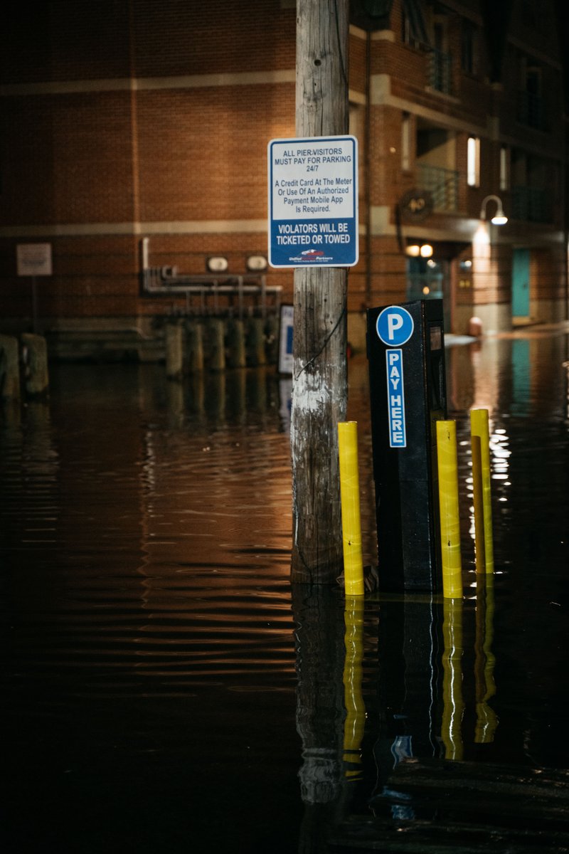
Sea-level rise is driving more frequent and widespread coastal flooding along Maine’s ~5,400 miles of tidally-influenced coastline, and communities face an urgent need to adapt. Near and long-term flood projections that combine local observations of water levels and flood impacts are foundational to adaptation.
Maine faces significant barriers to building coastal flood resilience due to (1) sparse tide gauge coverage and observation-based flood thresholds; and (2) the lack of a network of researchers, civic leaders, engaged community members (particularly youth), and resilience practitioners ready to leverage data to support coastal planning and resilience.
In this Stage 2 Project, funded by the National Science Foundation Civic Innovation Challenge, the Gulf of Maine Research Institute will lead a team of civic, community, education, and industry partners in building social and technological infrastructure to expand the collection of local data and leverage it for building coastal resilience.
This project will feature four coastal Maine communities that already experience regular flooding and have a range of demographics and municipal capacities: Portland, Boothbay Harbor, St. George, and Machias. We are installing Hohonu tide gauges in the four communities and partnering with in-community organizations to develop local capacity for running and sustaining coastal flooding community science programs that collect geo- and time-referenced flood impact data.
We will support the translation of data to decision-making by (1) providing customized data products and non-competitive mini-grants that support ongoing resilience projects in each community; and (2) developing interactive data platforms that provide intuitive displays of water level and flood impact data.
We are engaging youth by piloting a three-part curriculum with a cohort of middle and high school teachers that (1) develops a conceptual understanding of the physical drivers of coastal flooding, (2) prepares students for contributing data to the coastal flooding community science program, and (3) supports participation in a facilitated coastal resilience learning exercise alongside adult community members.
NSF Civic Innovation Challenge Stage 1 Recap
This project builds on a 6-month "Stage 1" pilot, where we began working with communities to assess local flood risk. Watch the video below to learn more.
Project Team
Project Sponsor:
This project is generously supported by the National Science Foundation, including the Directorate of Geosciences and the EPSCoR program.
Project Partners:
Town of Machias:
- Sunrise County Economic Council
- The University of Maine at Machias
- Machias Downtown Resilience Committee
- Downeast Coastal Conservancy
- Maine Coast Heritage Trust
Town of St. George:
- Knox County Emergency Management Agency
- St. George Resiliency Committee
- Herring Gut Coastal Science Center
Town of Boothbay Harbor:
City of Portland:
School Partners:
Data Access and Technology Partners:
Project Advisors:
Read More
-
![With sea levels rising, Maine group seeks tide watchers]()
With sea levels rising, Maine group seeks tide watchers
Press Clips
-
![Planning Forward for Stronger Coastal Communities]()
Planning Forward for Stronger Coastal Communities
Our Municipal Climate Action Program launches a new climate strategy workshop called Planning Forward.
Tidings
-
![Maine climate scientists warn of more frequent king tide flooding without storms]()
Maine climate scientists warn of more frequent king tide flooding without storms
Press Clips
-
![The Value of Community Science]()
The Value of Community Science
We learn from experts about community science — scientific research and monitoring driven and controlled by local communities — and what makes it such an …
Perspectives


